Historical Sites on ADV Bikes: Lochiel
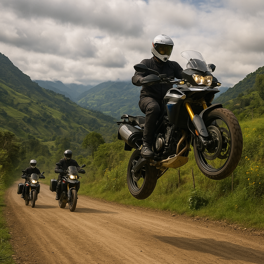
Tired of riding the same routes each month? Get out and explore Arizona's rich history with our series of Historical Sites for ADV Bikes!
Reaching Lochiel ranks a 1 out of 5 difficulty rating unless it's rained and made a mess of the road... then it becomes a 2; still beginner friendly just be vigilant. After leaving Patagonia, pavement fades fast, replaced by wide dirt roads, washboard, loose rock, and the occasional sandy section; making it ideal for riders who like their scenery remote. The route flows through open ranch land and high-desert grasslands with long sightlines, minimal traffic, and plenty of free-range cattle that couldn’t care less about your travel plans. It’s not a technical beatdown, but it’s remote, quiet, and unforgiving if you’re unprepared, ending at the eerie border ghost town of Lochiel where history, isolation, and a strong “don’t break down here” energy collide.
Enjoy the history:
The Silent Sentinel of the San Rafael: A Journey to Lochiel, Arizona
Deep in the rolling grasslands of the San Rafael Valley, where the golden grass waves like an inland sea against the backdrop of the Patagonia and Huachuca Mountains, lies a place that time hasn't just forgotten—it has intentionally left it alone.
Lochiel, Arizona, is more than just a ghost town. It is a hauntingly beautiful border settlement that serves as a living museum of the Old West, a testament to the boom-and-bust cycles of American mining, and a quiet witness to centuries of international history. To visit Lochiel is to step out of the frantic pace of the 21st century and into a landscape of profound silence and immense sky.
A Geography of Isolation
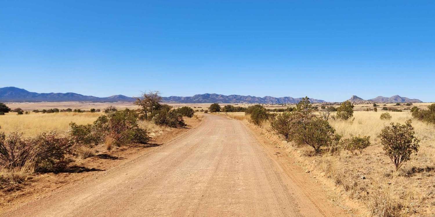
Lochiel sits directly on the United States-Mexico border, approximately 25 miles east of Nogales. However, those 25 miles are not a quick highway cruise. Reaching Lochiel requires a journey down Washington Camp Road, a winding, unpaved track that snakes through the mountains before spilling out into the high-altitude prairies of the San Rafael Valley.
This valley is one of the most ecologically significant landscapes in the Southwest. Because it sits at an elevation of roughly 4,700 feet, it avoids the scorched-earth heat of the lower Sonoran Desert. Instead, it offers a temperate, "Sky Island" environment that looks more like the steppes of Central Asia or the plains of Montana than the typical Arizona cactus-scape.
The Rise of a Border Hub
In the late 19th century, Lochiel was far from the silent cluster of ruins it is today. Founded in the 1880s, the town was originally named Luttrell, but it was renamed by rancher and businessman Colin Cameron, who established the famed San Rafael Ranch. Cameron, a man of Scottish descent, gave the settlement the name Lochiel after his ancestral home.
At its peak, Lochiel was a bustling port of entry. It boasted: two general stores, three saloons, a boarding house, a post office (established in 1884), and a customs house to monitor the flow of goods and people between the U.S. and Mexico. The town served as the primary supply hub for the nearby mining camps of Washington Camp and Duquesne. While the miners pulled silver, lead, and copper from the hills, the ranchers in Lochiel raised some of the finest Hereford cattle in the Southwest. For a brief moment in history, Lochiel was a vital artery of commerce, vibrating with the sound of wagon wheels and the multilingual chatter of border life.
The Architecture of Memory
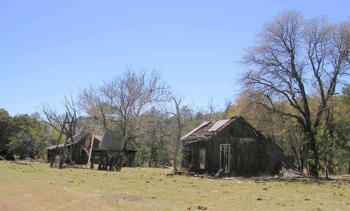
Today, only a handful of structures remain in Lochiel, but they are among the most photographed and evocative ruins in the state.
- The Lochiel Schoolhouse: Perhaps the most iconic building is the one-room schoolhouse. Built with sturdy red brick and topped with a peaked roof, it stands as a symbol of the community's former permanence. Though its windows are now vacant stares into the valley, the craftsmanship remains evident. It served the children of local ranchers and customs officials well into the mid-20th century.
- The Customs House: The old U.S. Customs station is a reminder of a different era of border security. In the early 1900s, the "border" was a much more fluid concept. The building remains a stark, utilitarian structure that once housed the officials responsible for patrolling the vast, open stretches of the valley.
- The San Rafael Ranch: While technically just outside the town proper, the San Rafael Ranch is the heart of the region. This Victorian-style ranch house is so architecturally preserved and the surrounding landscape so pristine that it has served as the filming location for classic Westerns like Oklahoma! and McLintock!.
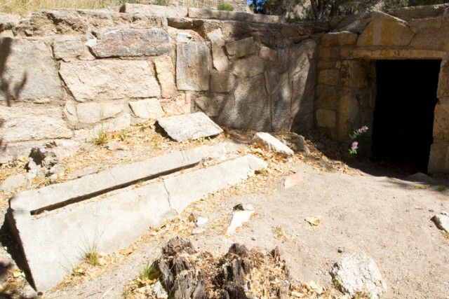
Fray Marcos de Niza: A Monument in the Middle of Nowhere
One of the most surprising sights in Lochiel is a large stone monument dedicated to Fray Marcos de Niza.
In 1539, de Niza, a Franciscan friar, is believed to have entered what is now the United States through this very valley. He was the first European to explore the American Southwest, searching for the mythical "Seven Cities of Gold." While he found no gold, his journey paved the way for the Coronado Expedition a year later. Standing before the monument today, it is staggering to realize that this quiet, dusty corner of Arizona was the literal gateway for European exploration of the Western United States. The monument was erected in 1939 to mark the 400th anniversary of his arrival, and it remains a lonely sentinel in the grass.
Pancho Villa and the Ghost of Revolution
Lochiel’s history isn't just one of quiet ranching; it has seen its share of violence and revolution. During the Mexican Revolution, the border was a flashpoint of tension. Legend has it that Pancho Villa and his revolutionaries frequented the area, occasionally crossing into Lochiel to procure supplies or evade Mexican federal forces. The town lived in a state of perpetual readiness, with residents never quite sure if the dust cloud on the horizon signaled a friendly neighbor or a revolutionary raid. This period of instability contributed to the town's eventual decline, as the once-porous border began to harden.
Why Visit Lochiel Today?
You don’t go to Lochiel for amenities. There are no gas stations, no gift shops, and no cell service. You go to Lochiel for the experience of the void.
The silence in the San Rafael Valley is physical. Without the hum of electricity or the drone of distant traffic, you hear things that are usually lost: the dry rattle of grass stalks, the cry of a hawk, and the wind whistling through the eaves of the abandoned schoolhouse.
For birders and nature lovers, Lochiel is a pilgrimage site. The valley is home to the rare Baird’s Sparrow and serves as a corridor for jaguars and ocelots moving between the mountain ranges of Mexico and Arizona. It is one of the few places left where you can see the landscape exactly as it appeared to the Apache tribes and Spanish explorers centuries ago.
The light in Lochiel is a photographer's dream. During the "golden hour," the sun hits the yellow grasses and the red brick of the schoolhouse, creating a palette of ochre and crimson that feels like a painting. The lack of light pollution also makes it one of the premier spots in Arizona for astrophotography.
Essential Tips for the Modern Traveler
If you decide to make the trek to Lochiel, you must be prepared. This is "Old Arizona," and it does not suffer fools.
- This area is generally suitable for large ADV bikes however, while the road is often graded, summer monsoons can wash out sections of the path, and winter snow can turn the dirt into impassable "gumbo" mud.
Pack more water than you think you need. Patagonia is the last reliable place for fuel and food before you head into the valley.
Respect the Border. Lochiel is located directly on the international line. While there is a vintage cattle fence marking the boundary, it is a patrolled area. Be mindful of private property and federal regulations regarding the border.
In the eyes of a developer, Lochiel is a failure - a town that disappeared. But in the eyes of a historian, an artist, or a seeker of solitude, it is a resounding success. It remains a sanctuary for the spirit of the frontier. Standing at the de Niza monument, looking south toward the blue peaks of Mexico and north toward the endless Arizona prairie, you realize that Lochiel isn't just a ghost town. It is a bridge between nations, between centuries, and between the wild world and the one we have built for ourselves. In the tall grass of Lochiel, the past isn't dead; it isn't even past. It’s just waiting for someone to drive down a long dirt road and listen to what the wind has to say.